Trail On foot Viroinval - Rivelottes - Photo

Randonnées du CGT GUIDE+

© OpenStreetMap contributors
Length
Length
3.6 km
Max alt
Max alt
226 m
Uphill gradient
Uphill gradient
95 m
Km-Effort
Km-Effort  
4.8 km
Min alt
Min alt
131 m
Downhill gradient
Downhill gradient
98 m
Boucle
Boucle
Yes
Creation date :
2022-02-08 11:34:30.193
Updated on :
2022-02-21 10:15:48.39

(0 Reviews)

On foot
On foot
1h05
Difficulty : Easy

Scan this QR Code to open this trail in the SityTrail application

FREE GPS app for hiking

Logo SityTrail SityTrail

IGN / Geographical institutes

Download SityTrail from the App Store Download SityTrail from Google Play

Logo SityTrail SityTrail World

The world is yours!

Download SityTrail from the App Store Download SityTrail from Google Play Download SityTrail on Huawei AppGallery

About

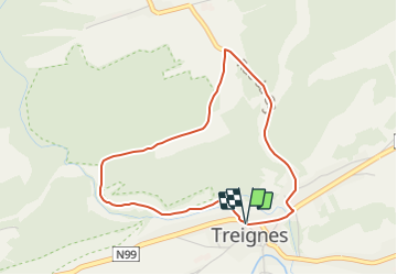
Trail On foot of 3.6 km to be discovered at Wallonia, Namur, Viroinval. This trail is proposed by Commissariat général au Tourisme.

Description

Trail created by Pays des Lacs.


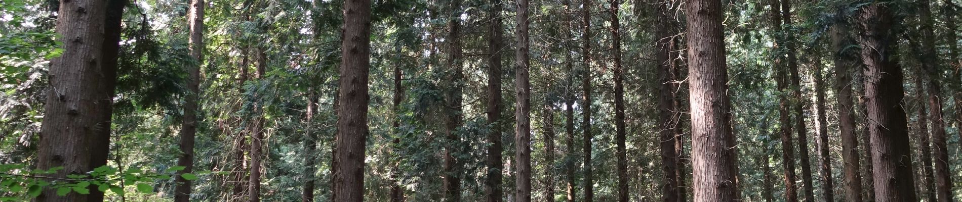
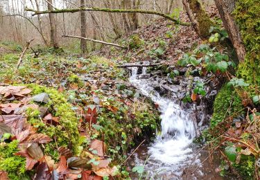
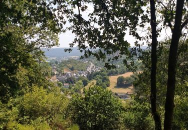
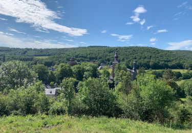
The short Rivelottes walk only reveals a tiny part of La Calestienne which is Natura 2000 listed. However, it gives you an idea of the biological wealth on this site: a magnificent chalk grassland, and a forest at the bottom of the valley where ash trees dominate alongside elms, alders, rowans and elderberry trees. The chalky grassland came from the practice of extensive grazing, i.e. there were few animals per hectare. The end of the walk is along a quarry that is no longer in operation. It is not uncommon to see wild carrots and oregano there. Or you may even come across a slow worm, the lizard with no feet.


Elevation profile

Photos

Positioning

Country:
Belgium
Region :
Wallonia
Department/Province :
Namur
Municipality :
Viroinval
Location:
Unknown
Start:(UTM)
619379 ; 5550288 (31U) N.

Trails nearby

Trail Walking Viroinval - Balade dans le Viroinval - De Vierves à Olloy - Photo
Walking
GUIDE
Desrumaux

Walking

Very easy
(2)
Viroinval, Wallonia, Namur, Belgium
8.9 km | 12.7 km-effort
4h 17min
Yes
Trail Walking Viroinval - RB-Na-12 Ed4 Balade franco-belge chez Toine Culot - Photo
Walking
PRO

Walking

Medium
(2)
Viroinval, Wallonia, Namur, Belgium
14.8 km | 21 km-effort
6h 13min
Yes
Trail Walking Viroinval - Balade dans le Viroinval - De Vierves à Olloy - Photo
Walking
GUIDE
Desrumaux

Walking

Easy
(1)
Viroinval, Wallonia, Namur, Belgium
10.5 km | 14 km-effort
3h 3min
Yes
Trail Walking Viroinval - Vierves. Natura 2000, des sites qui valent le détour ! Na6 - Photo
Walking
GUIDE+

Walking

Easy
(2)
Viroinval, Wallonia, Namur, Belgium
9.7 km | 12.7 km-effort
2h 41min
Yes
Trail Walking Viroinval - Mazée, sur le sentier des Douaniers - Photo
Walking
GUIDE
Desrumaux

Walking

Very easy
(1)
Viroinval, Wallonia, Namur, Belgium
7.6 km | 10.5 km-effort
4h 2min
Yes
Trail Walking Vireux-Molhain - Balade Franco-Belge - De Vireux-Molhain à Mazée - Photo
Walking
tracegps

Walking

Medium
(1)
Vireux-Molhain, Grand Est, Ardennes, France
14.4 km | 19.2 km-effort
3h 30min
Yes
Trail Walking Vireux-Molhain - Du Mont Vireux au château de Hierges - Photo
Walking
tracegps

Walking

Difficult
(1)
Vireux-Molhain, Grand Est, Ardennes, France
12.3 km | 16.8 km-effort
4h 0min
Yes
Trail Mountain bike Viroinval - Vierves - Olloy - Petigny - Nismes - Photo
Mountain bike
Chris Tian

Mountain bike

Difficult
(1)
Viroinval, Wallonia, Namur, Belgium
34 km | 42 km-effort
2h 9min
Yes
Trail Nordic walking Viroinval - VNW - Olloy-sur-viroin - 1 Fond de chênaux - Photo
Nordic walking
hannodi

Nordic walking

Medium
(1)
Viroinval, Wallonia, Namur, Belgium
5 km | 6.5 km-effort
1h 3min
Yes


Close
My subscriptions