Trail On foot Anhée - Les Abbayes - Photo

Les Abbayes

Randonnées du CGT GUIDE+

© OpenStreetMap contributors
Length
Length
3.3 km
Max alt
Max alt
242 m
Uphill gradient
Uphill gradient
77 m
Km-Effort
Km-Effort  
4.3 km
Min alt
Min alt
174 m
Downhill gradient
Downhill gradient
77 m
Boucle
Boucle
Yes
Creation date :
2022-02-08 11:31:20.549
Updated on :
2022-02-21 10:12:41.145

(0 Reviews)

On foot
On foot
58m
Difficulty : Easy

Scan this QR Code to open this trail in the SityTrail application

FREE GPS app for hiking

Logo SityTrail SityTrail

IGN / Geographical institutes

Download SityTrail from the App Store Download SityTrail from Google Play

Logo SityTrail SityTrail World

The world is yours!

Download SityTrail from the App Store Download SityTrail from Google Play Download SityTrail on Huawei AppGallery

About

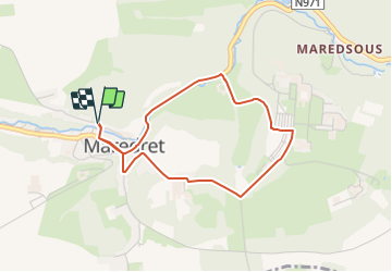
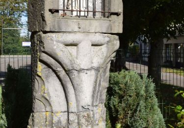
Trail On foot of 3.3 km to be discovered at Wallonia, Namur, Anhée. This trail is proposed by Commissariat général au Tourisme.

Description

Trail created by Vallée de la Meuse Namur-Dinant.


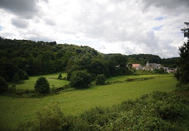
Walk of a little less than 6 kilometers to discover the Abbeys of Maredret and Maredsous.


You start along the Ravel, turn right and walk along the river Molignée. Just before the Castle of Maredsous, turn left and go up the asphalt road to the Abbey of Maredsous.

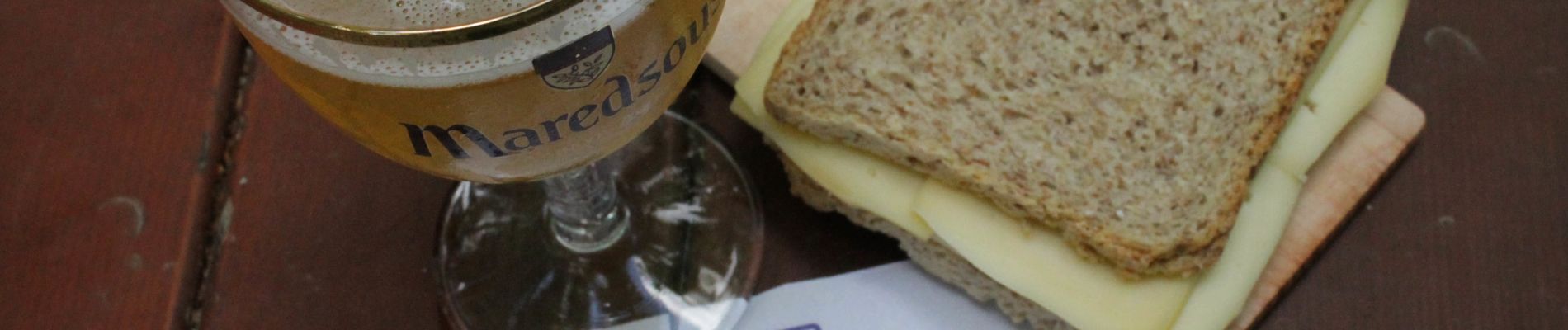
Here you can have a break and taste the traditional beer and cheese sandwiches.

Then, when you arrive at the Abbey, you drive along the parking lot and turn right after about one kilometer. You arrive at the Abbey of Maredret and walk down the street to the starting point.


Elevation profile

Photos

Positioning

Country:
Belgium
Region :
Wallonia
Department/Province :
Namur
Municipality :
Anhée
Location:
Unknown
Start:(UTM)
624663 ; 5573550 (31U) N.

Trails nearby

Trail Walking Mettet - RB-Na-23-Sur le plateau de l’Entre-Sambre-et-Meuse - Photo
Walking
PRO

Walking

Very difficult
(8)
Mettet, Wallonia, Namur, Belgium
24 km | 29 km-effort
6h 39min
Yes
Trail Walking Anhée - RB-Na-22-raccourci_Vignobles-et-Jardins-d’eau - Photo
Walking
PRO

Walking

Very difficult
(5)
Anhée, Wallonia, Namur, Belgium
16.7 km | 21 km-effort
4h 52min
Yes
Trail Walking Anhée - RB-Na-22_Vignobles-et-Jardins-d’eau - Photo
Walking
PRO

Walking

Very difficult
(11)
Anhée, Wallonia, Namur, Belgium
19.5 km | 25 km-effort
5h 46min
Yes
Trail Walking Anhée - RB-Na-16 - Paysages de la Molignée - Photo
Walking
PRO

Walking

Medium
(16)
Anhée, Wallonia, Namur, Belgium
18.3 km | 24 km-effort
5h 13min
Yes
Trail Walking Mettet - RB-Na-23-racc-Sur le plateau de l’Entre-Sambre-et-Meuse - Photo
Walking
PRO

Walking

Difficult
(7)
Mettet, Wallonia, Namur, Belgium
14 km | 16.7 km-effort
3h 47min
Yes
Trail Walking Anhée - RB-Na-16 Raccourci - Paysages de la Molignée - Photo
Walking
PRO

Walking

Easy
(15)
Anhée, Wallonia, Namur, Belgium
13 km | 16.6 km-effort
3h 40min
Yes
Trail Walking Anhée - Balade de l'abbaye de Maredsous à Ermeton-sur-Biert - Photo
Walking
GUIDE
Desrumaux

Walking

Easy
(4)
Anhée, Wallonia, Namur, Belgium
9.2 km | 11.9 km-effort
2h 32min
Yes
Trail Walking Anhée - Sosoye - Circuit Natura 2000, des sites qui valent le détour - Na11 - Photo
Walking
GUIDE+

Walking

Medium
(5)
Anhée, Wallonia, Namur, Belgium
4.9 km | 6.3 km-effort
1h 21min
Yes
Trail Walking Anhée - Balade à Denée - Photo
Walking
GUIDE
Desrumaux

Walking

Very easy
(1)
Anhée, Wallonia, Namur, Belgium
5.8 km | 7.4 km-effort
1h 35min
Yes


Close
My subscriptions