Trail Walking Erquelinnes - Promenade au bord de la Hantes  - Photo

Promenade au bord de la Hantes

« L’heure de la fin des découvertes ne sonne jamais. » Colette GUIDE+

© OpenStreetMap contributors
Length
Length
5.9 km
Max alt
Max alt
156 m
Uphill gradient
Uphill gradient
67 m
Km-Effort
Km-Effort  
6.8 km
Min alt
Min alt
124 m
Downhill gradient
Downhill gradient
67 m
Boucle
Boucle
Yes
Creation date :
2021-12-30 20:37:57.399
Updated on :
2022-01-20 10:29:21.542

(2 Reviews)

Walking
Walking
1h32
Difficulty : Medium

Scan this QR Code to open this trail in the SityTrail application

FREE GPS app for hiking

Logo SityTrail SityTrail

IGN / Geographical institutes

Download SityTrail from the App Store Download SityTrail from Google Play

Logo SityTrail SityTrail World

The world is yours!

Download SityTrail from the App Store Download SityTrail from Google Play Download SityTrail on Huawei AppGallery

About

Trail Walking of 5.9 km to be discovered at Wallonia, Hainaut, Erquelinnes. This trail is proposed by Au fil de nos découvertes.

Description

🅿️ Départ et Parking:
Eglise Saint-Remy
Rue des fontaines
6560 Hantes-Wihéries

▶️ Suivre la balise « rectangle bleu ou rectangle blanc et bleu »
(De l’église, remontez la rue d’une vingtaine de mètres et sur votre gauche, se trouve un petit chemin, vous l’empruntez. Au bout de ce chemin, prenez à droite et vous tomberez sur les premières balises à gauche)

🌲🌳

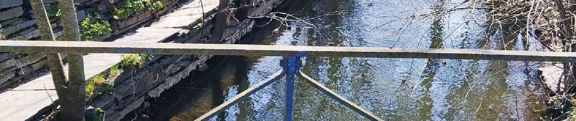
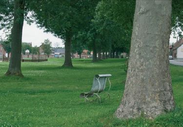
Jolie promenade dans les campagnes, vous suivrez la Hantes mais en hauteur! 💦
Profitez du calme de cette promenade ! 🤗

Possibilités de pique-niquer. 🥪🍴
Chiens autorisés en laisse. 🐩🐶🐕
Convient pour les enfants . 👱👱‍♂️
Ne convient pas pour les poussettes et personnes à mobilité réduite. 👨‍🦽👩‍🦽👶

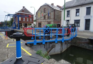
Dans ce coin, se trouve le pont romain qui est vraiment à voir! (Rue du Pont Romain, 6560 Erquelinnes) ❤️

N'hésitez pas à aller faire un tour sur notre site internet et nos réseaux :
www.aufildenosdecouvertes.com
www.facebook.com/aufildenosdecouvertes
https://www.instagram.com/au_fil_de_nos_decouvertes/

Elevation profile

Photos

Positioning

Country:
Belgium
Region :
Wallonia
Department/Province :
Hainaut
Municipality :
Erquelinnes
Location:
Unknown
Start:(UTM)
583832 ; 5573369 (31U) N.

Comments

Please log in to post a review or rate the element


Trails nearby

Trail Walking Merbes-le-Château - GG-Ht-05_Labuissière - Landelies - Photo
Walking
PRO

Walking

Very difficult
(1)
Merbes-le-Château, Wallonia, Hainaut, Belgium
21 km | 26 km-effort
5h 33min
No
Trail Walking Merbes-le-Château - RB-Ha-12 - Dans le parc naturel des Hauts-Pays - Photo
Walking
PRO

Walking

Very difficult
(2)
Merbes-le-Château, Wallonia, Hainaut, Belgium
23 km | 27 km-effort
6h 6min
Yes
Trail Walking Merbes-le-Château - De Merbes-le-Château à Labuissière - Photo
Walking
GUIDE
Desrumaux

Walking

Easy
(2)
Merbes-le-Château, Wallonia, Hainaut, Belgium
13.2 km | 14.8 km-effort
3h 15min
Yes
Trail Walking Merbes-le-Château - De Labuissiere vers Fontaine-Valmont par la Vallee de la Sambre - Photo
Walking
GUIDE
Desrumaux

Walking

Easy
(1)
Merbes-le-Château, Wallonia, Hainaut, Belgium
9.2 km | 10.8 km-effort
2h 15min
Yes
Trail Nordic walking Erquelinnes - 6560-05 - Hantes-Wihéries - 9,9km - 104m - Photo
Nordic walking

Nordic walking

Very easy
(1)
Erquelinnes, Wallonia, Hainaut, Belgium
9.9 km | 11.3 km-effort
Unknown
Yes
Trail On foot Lobbes - Promenade de Landelin - Photo
On foot
GUIDE+

On foot

Easy
Lobbes, Wallonia, Hainaut, Belgium
6.3 km | 7.2 km-effort
1h 37min
Yes
Trail On foot Erquelinnes - Promenade de la Haute Sambre - Photo
On foot
GUIDE+

On foot

Easy
Erquelinnes, Wallonia, Hainaut, Belgium
9 km | 10.2 km-effort
2h 18min
Yes
Trail On foot Erquelinnes - Sur les traces de la frontière hollandaise - Photo
On foot
GUIDE+

On foot

Easy
Erquelinnes, Wallonia, Hainaut, Belgium
6.9 km | 8.2 km-effort
1h 51min
Yes
Trail On foot Merbes-le-Château - Promenade des Batelières - Photo
On foot
GUIDE+

On foot

Easy
Merbes-le-Château, Wallonia, Hainaut, Belgium
4.5 km | 5.1 km-effort
1h 9min
Yes


Close
My subscriptions