Trail On foot Aubel - abbaye val dieu - saint jean sart vf - Photo

abbaye val dieu - saint jean sart vf

Hiking inspiration PRO

© OpenStreetMap contributors
Length
Length
10.9 km
Max alt
Max alt
255 m
Uphill gradient
Uphill gradient
251 m
Km-Effort
Km-Effort  
14.3 km
Min alt
Min alt
127 m
Downhill gradient
Downhill gradient
253 m
Boucle
Boucle
Yes
Creation date :
2020-05-26 07:11:17.81
Updated on :
2020-06-22 17:50:26.615

(0 Reviews)

On foot
On foot
1h30
Difficulty : Easy

Scan this QR Code to open this trail in the SityTrail application

FREE GPS app for hiking

Logo SityTrail SityTrail

IGN / Geographical institutes

Download SityTrail from the App Store Download SityTrail from Google Play

Logo SityTrail SityTrail World

The world is yours!

Download SityTrail from the App Store Download SityTrail from Google Play Download SityTrail on Huawei AppGallery

About

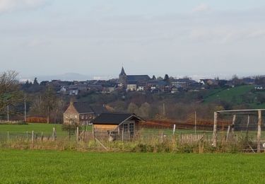
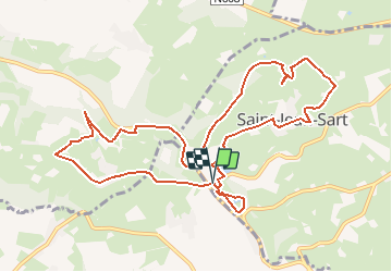
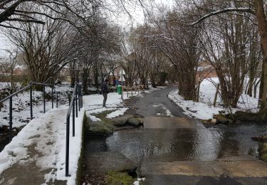
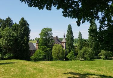
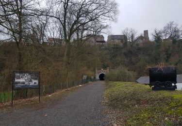
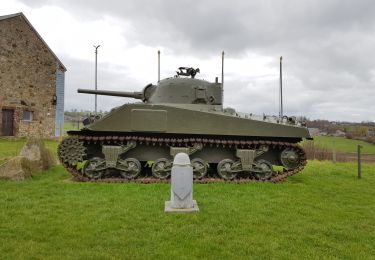
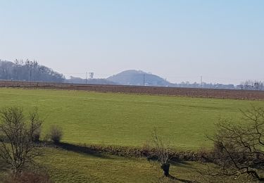
Trail On foot of 10.9 km to be discovered at Wallonia, Liège, Aubel. This trail is proposed by Rando bière.

Description

Hello, 😁
Je vous propose de me rejoindre pour une rando/bière du côté de Val dieu !

Info rando :
👣 11KM : D 255📈 et D -251📉
⏳ Durée moyenne : entre 3h30 et 4h30
🚗 30 minutes  depuis Liège (26KM)
⚪ : rando peu exigeante physiquement
💧Prévoir au moins 1L d'eau (minimum)
🥾 Prévoir des chaussures de marche
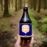
🍻  Abbaye val dieu : https://www.abbaye-du-val-dieu.be/fr/
🌡Météo : https://www.meteoblue.com/fr/meteo/semaine/aubel_belgique_2802985


Merci à Madame Bougeotte pour la découverte ! :-)

Pour les curieux voici le lien d'un article concernant le livre "Randos bière en Belgique" de Madame Bougeotte :

https://madamebougeotte.com/regard-sur-le-monde/randos-biere-belgique-livre/

Elevation profile

Photos

Positioning

Country:
Belgium
Region :
Wallonia
Department/Province :
Liège
Municipality :
Aubel
Location:
Aubel
Start:(UTM)
698002 ; 5620055 (31U) N.

Trails nearby

Trail Walking Aubel - autour de val dieu  - Photo
Walking
GUIDE
blechanteur

Walking

Very easy
(6)
Aubel, Wallonia, Liège, Belgium
9.5 km | 12.1 km-effort
2h 13min
Yes
Trail Walking Herve - Entre bois et GR (8km) - Photo
Walking
GUIDE+

Walking

Very easy
(5)
Herve, Wallonia, Liège, Belgium
7.7 km | 10.1 km-effort
Unknown
Yes
Trail Walking Thimister-Clermont - La Minerie - Photo
Walking
Ljacquine

Walking

Easy
(6)
Thimister-Clermont, Wallonia, Liège, Belgium
12.9 km | 15.7 km-effort
3h 22min
Yes
Trail Walking Thimister-Clermont - Froidthier - Photo
Walking
GUIDE
mumu.larandonneuse

Walking

Easy
(1)
Thimister-Clermont, Wallonia, Liège, Belgium
6.6 km | 7.9 km-effort
1h 48min
Yes
Trail Walking Voeren - La Commanderie 7  - Photo
Walking
GUIDE
mumu.larandonneuse

Walking

Easy
(1)
Voeren, Flanders, Limburg, Belgium
4.5 km | 6.3 km-effort
1h 26min
Yes
Trail Walking Dalhem - 2021-10-21_18h00m54_1397 - Photo
Walking
GUIDE
mumu.larandonneuse

Walking

Medium
(1)
Dalhem, Wallonia, Liège, Belgium
13.9 km | 17.6 km-effort
3h 59min
Yes
Trail Walking Thimister-Clermont - 2021-03-21_09h09m37_1413 - Photo
Walking
GUIDE
mumu.larandonneuse

Walking

Easy
(2)
Thimister-Clermont, Wallonia, Liège, Belgium
11.1 km | 13.6 km-effort
3h 5min
Yes
Trail Walking Herve - 2021-02-28_19h05m57_1156 (1) - Photo
Walking
GUIDE
mumu.larandonneuse

Walking

Very difficult
(1)
Herve, Wallonia, Liège, Belgium
16.4 km | 21 km-effort
4h 47min
Yes
Trail Walking Blegny - Mortier - Photo
Walking
GUIDE
mumu.larandonneuse

Walking

Medium
(4)
Blegny, Wallonia, Liège, Belgium
15.6 km | 21 km-effort
3h 35min
Yes


Close
My subscriptions